
Then & now.
Federal survey crews drew Duxbury seven times between 1885 and 1974. We lined every sheet up with today's topographic map in a single frame, from the Kingston line east to the Gurnet and the whole barrier beach. Drag the slider and watch a hundred and forty years pass through the same square of coast.
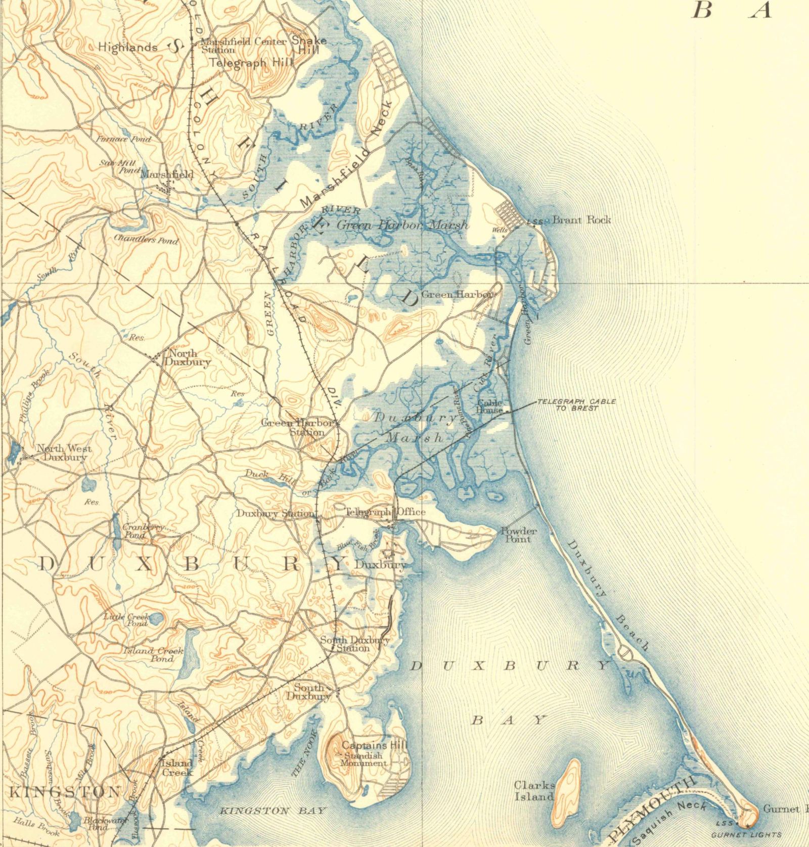
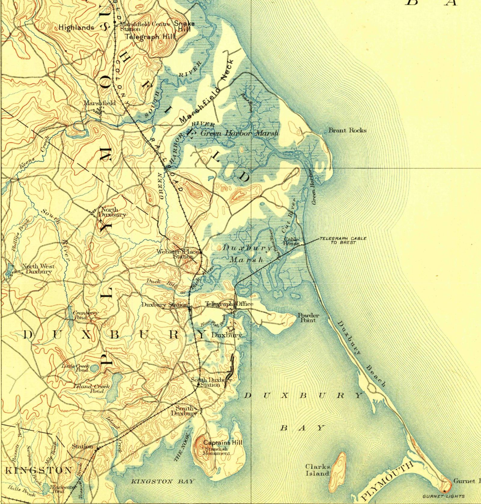
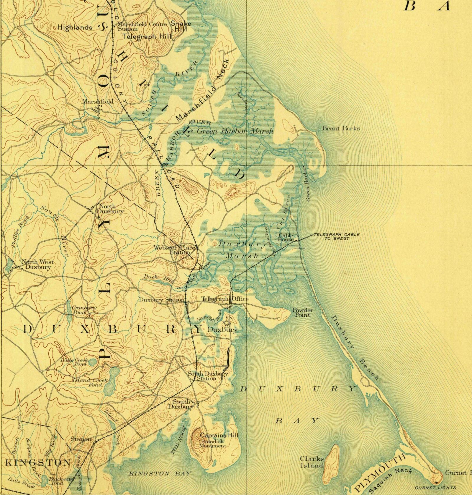
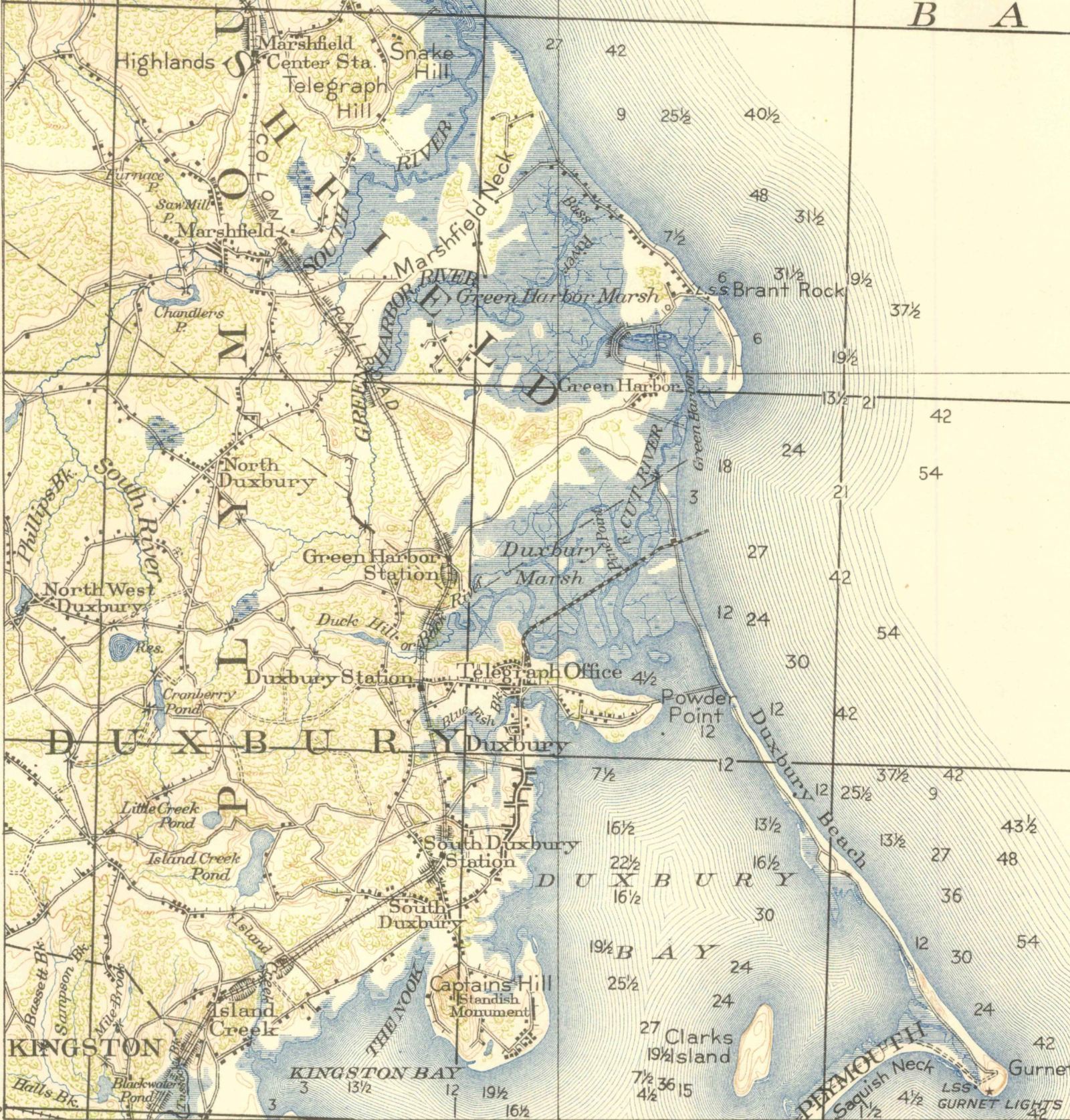
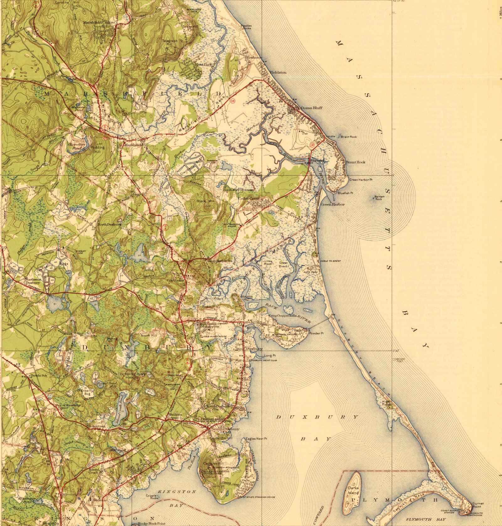
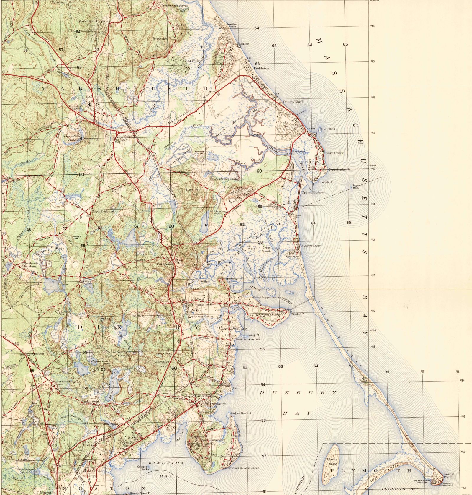
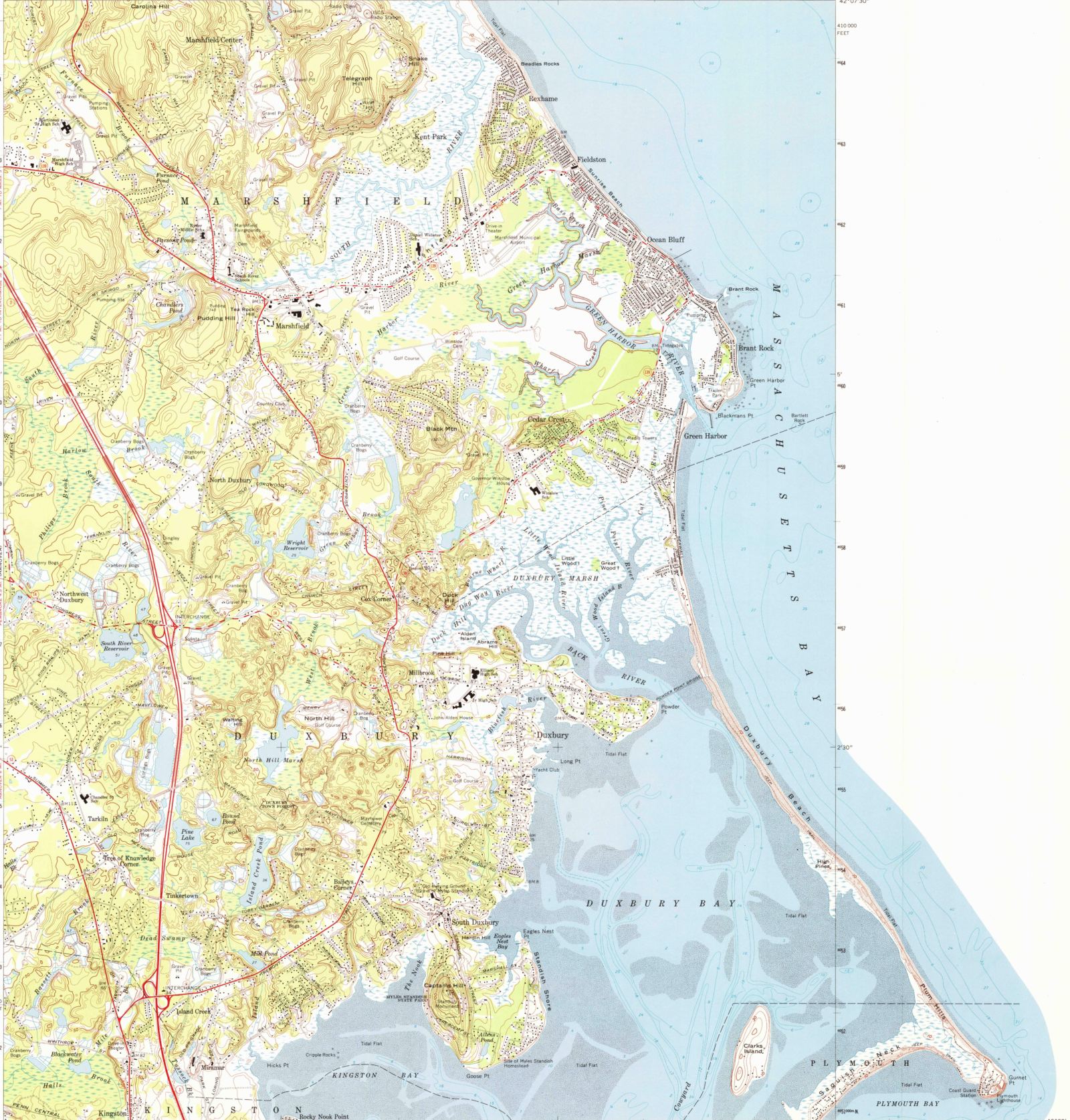
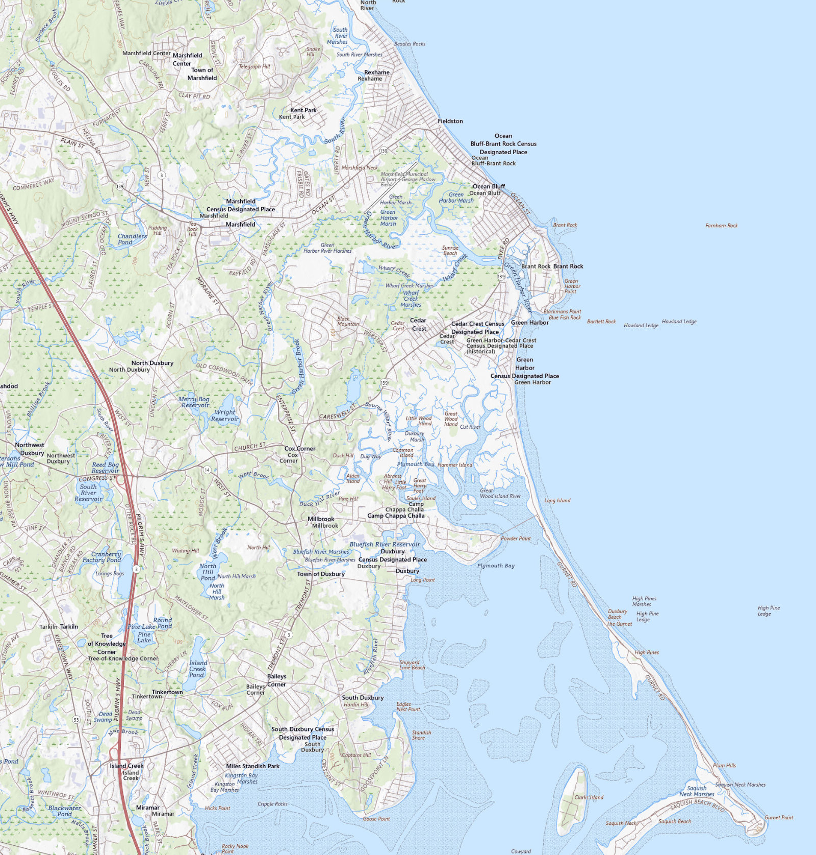
1885: the first federal survey of the town. No bridge yet.
Survey sheets: USGS Historical Topographic Map Collection · Today: USGS US Topo · All public domain · Aligned by survey grid · Not for navigation
What to look for.
Watch the bridge appear
Start at 1885, the first federal survey, and find the gap between Powder Point and the beach. Neither the 1885 nor the 1888 sheet has anything to draw there: the Powder Point Bridge opened in 1892. Nudge the slider to 1893 and it crosses to the beach in a single confident line, one year old and already the longest wooden bridge of its kind on the coast. The full story, including the current fight over its replacement, is in our bridge history.
The monument, labeled early
The 1893 sheet marks "Standish Monument" on Captain's Hill five years before the monument was done. The cornerstone went down in 1872, the money ran out partway up the shaft, and the cap didn't go on until 1898. The surveyors drew it anyway. More on that saga in our history of the town.
Ride the railroad while it lasts
The Duxbury & Cohasset line runs down every sheet into 1941, with Duxbury Station and South Duxbury Station labeled where the depots stood. Its presence on the 1941 sheet is a small mercy of survey lag: the last train ran in 1939. Watch what the later sheets do with the line, then watch Route 3, which opened through town in 1963, show up on the 1974 sheet to take over the job of moving everyone. How the railroad made the summer town is told in the summer resort era.
The border down the bay
The 1953 and 1974 sheets end at a formal border that runs straight down through the bay. The surveyors drew the beach and the Gurnet past their own line rather than cut them off, so on those two stops you can see both the border and the coast continuing beyond it. Government cartography bending its rules for a sandbar is about as Duxbury as it gets.
Smaller finds
The twin "Gurnet Lights" are starred at the tip of the beach on the 1893 sheet. On 1941, hunt for the National Sailors Home labeled out on Powder Point, with Camp Chappa Challa just to its north. And everywhere on the older sheets, notice what isn't there: most of the streets people live on now simply did not exist.
How this was made
Each sheet comes from the USGS Historical Topographic Map Collection, published as a georeferenced scan; the present-day layer is the current USGS US Topo, the same map series a century and a half on. We reprojected all eight, cropped them to one frame, and placed them by coordinate, so a point on the old map sits over the same point on the new one to within the accuracy of the original survey. The frame follows the reach of the 1941 sheet, which stretched east to take in the whole beach and the Gurnet. A 1977 sheet exists as well, but it is a photomap, an aerial photograph dressed up as a map, and this page keeps a rule: drawn maps only. The old surveys carry their own errors and charms; enjoy them, but do not navigate by them.
The Powder Point Bridge
A history of the Long Bridge, from a draw for tall vessels to the current battle over concrete.

The summer resort era
How a $1 train ride from Boston turned a shipbuilding town into a summer colony.
The living chart
Landmarks, legends, villages, and walks, each pinned where it belongs.